Guide to the Peaks of the Balkans Trail
WHAT YOU NEED TO KNOW BEFORE TREKKING THE POB
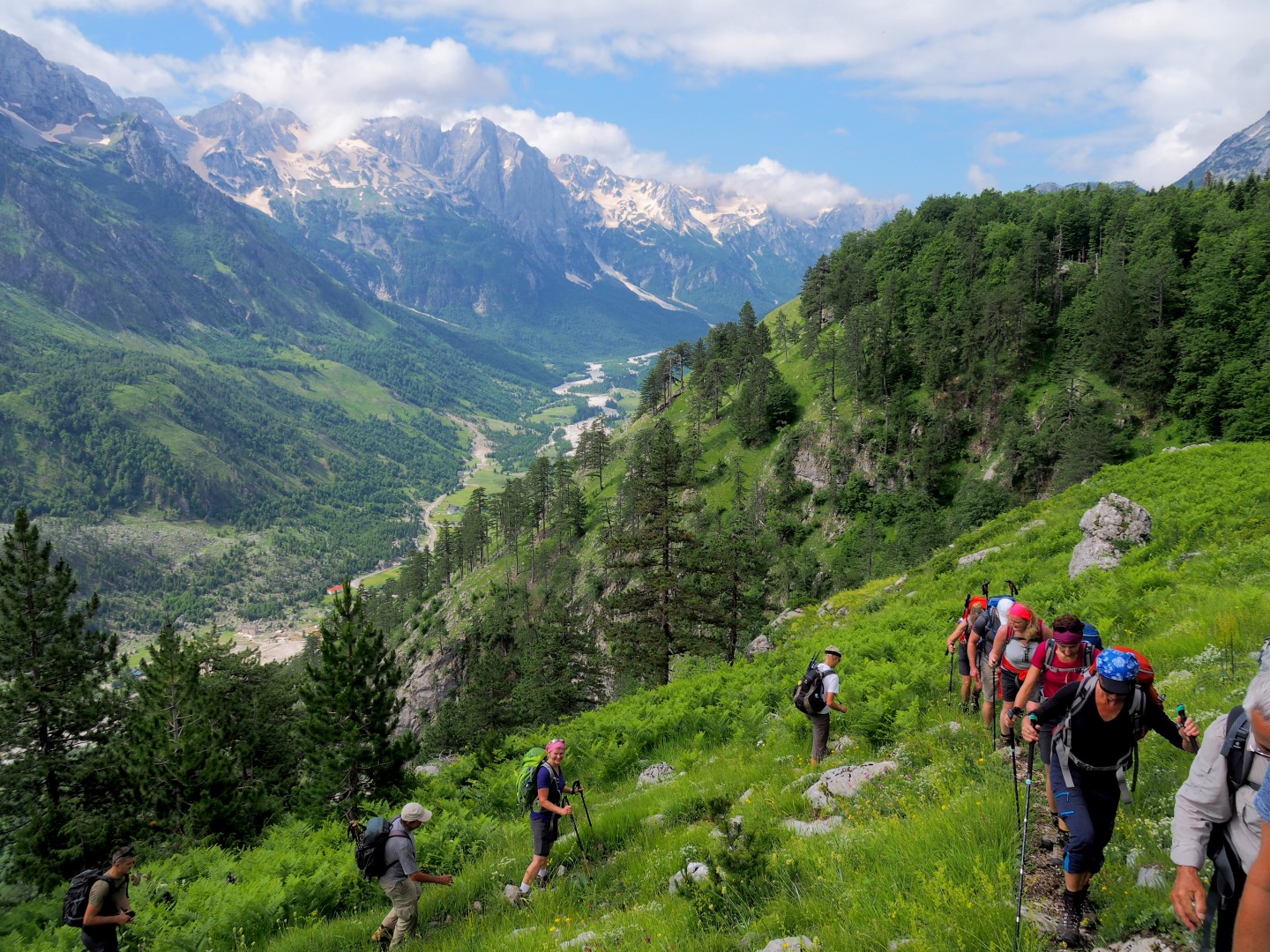
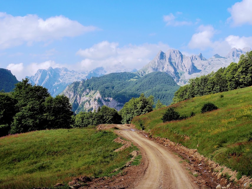
The Peaks of the Balkans Trail is a 192 kilometres (119 miles) long hiking route. Over the course of ten stages it crosses the border regions of Albania, Kosovo and Montenegro. Locally, this mountainous region, which forms the last stretch of the Dinaric Range, is known as Prokletije (Slavic) or Bjeshket e Namuna (Albanian). Both names translate to “Accursed Mountains”, a nod to their wild and unsurmountable appearance.
Walking the route would have been impossible just over a decade ago. But with the necessary infrastructure and a border crossing permit application system in place, one can now tackle this unique trek that connects the most amazing mountain areas of these three Western Balkans countries.
Keep in mind that the Peaks of the Balkans Trail is not a single path, it is more of concept that connects three different nations within one common mountain region. One can choose between a myriad of different routings according to personal preferences.
While the original route as described on the offical website and map might be the most practical for independent hikers, it is far from the most beautiful or best option for everybody else. Many slightly boring unpaved forestry roads can be replaced with more scenic hiking routes and skipped or shortened with short transfers, as they were incorporated mostly as a compromise to achieve all three countries’ similar shares of the route in the first place. Why not also attempt one of the many peaks along the route or include a side trip into the amazing Grbaja Valley and interesting Kelmend Region?
Peaks of the Balkans Trail Facts / Highlights
- 10 stages through five National Parks across three countries
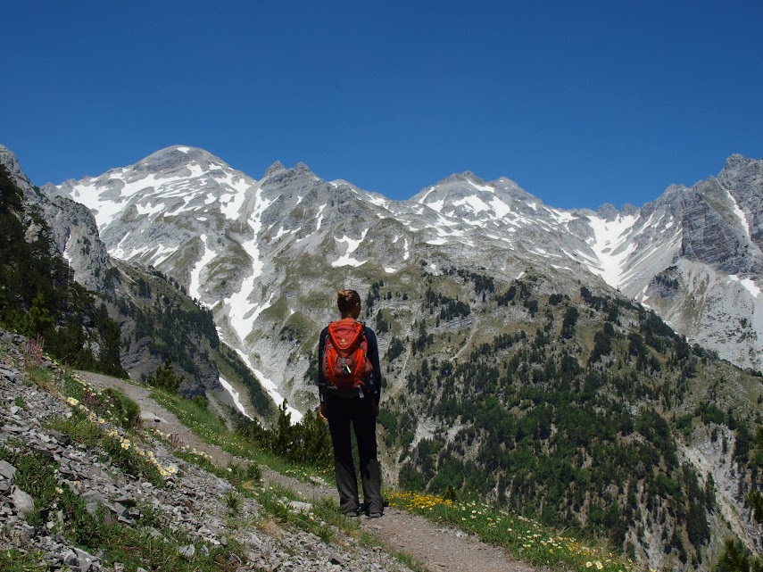
- Views of Jezerca, highest peak of the Dinaric Range at 2694 m
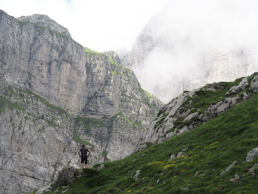
- Barren craggy limestone cliffs and high karst towers
- Dense, fairytale-like beech forest and seemingly endless stretches of conifer
- Alpine glacial scenery that saw the dinosaurs come and go
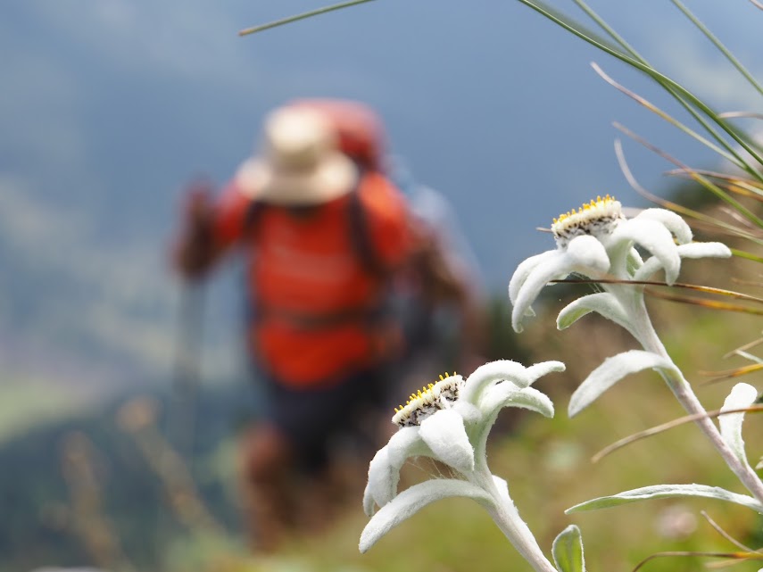
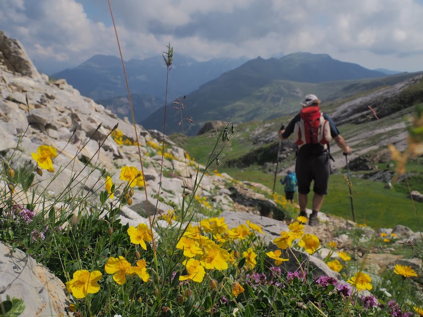
- Colourful meadows unrivalled in their biodiversity
- Hospitality of the highlanders who have defied the forces of nature for centuries

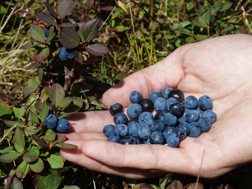
The best time to hike the Peaks of the Balkans route is from mid-June to mid-September. During this time, the weather is most stable and accommodation is reliably open along all stages of the trail. Most shepherds move to the meadows higher in the mountains from July to the end of August, when the low altitude meadows can’t support their livestock. During this time, the mountain slopes you pass are covered in blueberries and woods are full of forest fruit. In contrast, water source in the karst areas can run dry as soon as August.
Travelling outside this period is not impossible, but the conditions needs to be taken into consideration during the trip planning. Before mid-June, be prepared to encounter plenty of snow, particularly on altitudes above 1800 meters and on north facing slopes. If you’re trekking after mid-September, temperatures start to drop (especially during the nights) and chances of longer periods of rain increase. Furthermore, outside of the 3-month long summer period, some accommodation options are unavailable. Within the valleys most people stay from spring to the beginning of winter, but the shepherd settlement of Doberdol and huts of Milishevc see the shortest span of inhabitation. So unless you’re prepared to camp with your own tent and food, it is crucial to check in advance if accommodation is open to host you.
Best starting points for your trek are:
Shkodra, Albania: 90min drive from Mother Theresa International Airport near Tirana, 75min from Podgorica airport, transfer from here to Theth (3h drive) or with the Koman Ferry to Valbona. It’s also possible to
- Peja, Kosovo: 90min drive from Adem Jashari International Airport of Pristina, start your walk in the Rugova Canyon, 45min drive to village Reka e Allages
- Plav, Montenegro: 4-5h driving time from Podgorica airport
Next to the aforementioned hubs Tirana, Podgorica and Pristina, consider flying viaTivat (Montenegro), Dubrovnik (Croatia) or Corfu (Greece). Connections are often more affordable but require longer travel to the start point of the hike.
By Train: Bar, Podgorica, Kolasin and Bijelo Polje are served by the scenic train line which connects Serbia and Montenegro. You could travel from Munich within three days to those cities, one example itinerary:
- Munich (Germany) – Salzburg (Austria) – Ljubljana (Slovenia) – Zagreb (Croatia): many scenic stretches through Alps and along the Julian Alps
- Zagreb (Croatia) – Belgrade (Serbia): flat stretch, spend your time sightseeing Zagreb and take the night sleeper train
- Belgrade (Serbia) – Bosnia (9km stretch) – Montenegro (last station Bar): beautiful mountain scenery, highest railway bridge of Europe and steep gradient – don’t miss out on it!
Albania doesn’t have international connections and train travel is rather slow, the main station in Tirana was recently demolished and we advise against usage of trains for those reasons.
The Kosovarian town of Peja can be reached from Pristina, the country is connected by international trains to Macedonia (Skopje) and Serbia (Kraljevo).
By Car: Durres (Albania) and Bar (Montenegro) are the closest ports served by ferries from Italy (Bari, Brindisi, Ancona, Trieste). From central Europe travel either overland along the former autoput (Yugoslav Autobahn) via Salzburg, Villach, Ljubljana, Zagreb, Belgrade and Novi Pazar to reach Kosovo and the interior of Montenegro. Or choose the more scenic but probably slower route from Slovenia along the coast through Bosnia. Allow at least two days to cover the 1200km distance to Montenegro.
All starting points of the trail are accessible with public transport. In Montenegro and Kosovo the lines are served by coaches with a fixed timetable, in Albania shared minibuses (called furgon) operate without a fixed timetable, but the option to jump on/off wherever you like. Expect few or only one daily connection to most of the villages. In the more remote places there’s no regular line. It is possible to hire private cars for transfers, taxis exist only in the cities. Long stretches within the mountains can’t be accessed by car.
Baggage transfers can be organised upon request, completed with horses or mules from village to village. Please not that these transfers are only possible for soft pieces of luggage, i.e. duffle bags and backpacks. Suitcases cannot be fixed properly on the saddles and are therefore not recommended. While it is generally possible to walk with your luggage transfer, the horsemen often take shortcuts and move at a faster pace than the regular hiker, as they also need to return the same day. Transport by car is more difficult to organize for individuals. This is especially true for cross-border sections, as a special permit is necessary to avoid problems with the customs officials.
With regard to gradients, ascent and descent most will prefer to walk the route anticlockwise as outlined in the official map. The described 10 stages can be walked in 10 days. At this pace, the average walking time per day is 6-7 hours. Hikers preferring shorter walks should adapt the route accordingly. It is also possible to divide them into up to 13 sections to allow for shorter daily distances. Planned rest days should be added according to personal motivation and stamina.
Most of our guided tours last from 7 to 15 days. With less days at hand one cannot experience the Peaks of the Balkans without rushing or leaving out one country.
Permits are part of a special application system used by hikers who, during their hikes, cross the “green borders” between Albania, Kosovo and Montenegro. This is typically the case when hiking the Peaks of the Balkans trail. Regular borders at roads and airports do not require a permit, as passports are checked by immigration officers upon entry and exit.
The supposed process requires visitors to send an application form to the respective departing country’s border police. This contains personal details, copies of ID/passport, date, time and location of the intended crossing. Additionally, for the Montenegrin permit, a fee has to be paid at a local bank or post office within Montenegro. Afterwards, equipped with the payment slip, you can collect your permit at the border police station outside of Plav. In Albania and Kosovo permission is granted electronically and free of charge.
In reality, unfortunately, it has proven impractical to impossible for foreign visitors to apply with the police directly. Police officers often don’t speak sufficient English or don’t respond in time. Furthermore, the payment of the fee depends on opening times of institutions, while hikers will often arrive at a place after their closing times and usually want to leave before they reopen in the morning.
In order to still make it feasible for individual hikers to experience the Peaks of the Balkans Trail without risking problems with border patrols or immigration officers, we offer to take care of the application process for you, for a small fee. Go directly to the Border Crossing Permit Application Form, or get more detailed information about the permits and process here first.
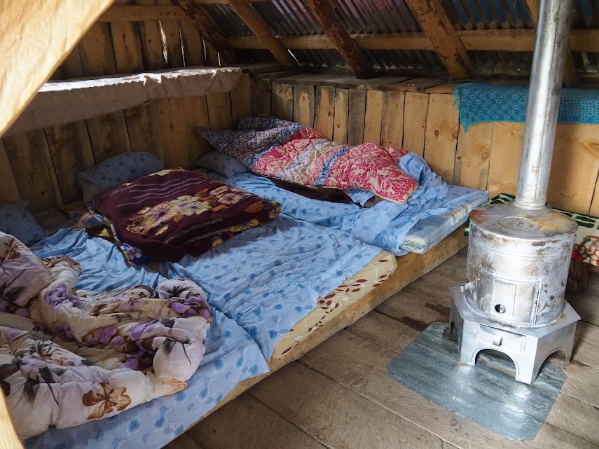
In Albania you will mostly find family-run guesthouses, in Montenegro rather small hotels and a mix of both in Kosovo. At the starting points you can find high-class hotels and B&Bs, within the mountains mostly simple lodges that offer dorm rooms and full board.
Standards vary, in Theth and Valbona, the points on the Peaks of the Balkans route which are most frequented by foreign travellers, one will find professional hosts and also ensuite double rooms. In Doberdol, a high altitude pasture, on the other hand you sleep rustically in simple huts with earthen floors and mattresses on a wooden platform, with limited electricity and showers. You should prepare accordingly and consider taking a sleeping bag (liner) or adapting the route to fit personal comfort expectations.
English isn’t widely spoken but slowly spreads, German can be often used in Kosovo talking with emigrants and also in Montenegro where there were many German-speaking visitors before the breakup of Yugoslavia. Be prepared to communicate with hands and feet, we also suggest to take a picture dictionary – this is especially helpful for food preferences. Especially in guesthouses you are cordially received by the family and quickly feel part of it. Grand mountain landscapes can be found in many places but those encounters turn a Peaks of the Balkans journey into a unique experience.
Need assistance booking your Peaks of the Balkans accommodation for your independent trip? Check the Accommodation Booking Form by out partner Trails of Albania specifically designed to make it as quick and easy as possible.
Pitching your own tent is possible almost everywhere, but we recommend to inquire with the closest resident for permission. Even though it is not obvious, meadows are owned by local families. Most of the time, they will happily accept and receive guests. A small gratuity should be left if you use facilities like shower and toilets, and board can also be provided.
In Montenegro it is not allowed to camp on non-designated sites or outside private property within the national parks. This is especially true for Lake Hrid. The biotope is classified as highest protection zone but evidently not all visitors abide by it. We kindly request all hikers to use existing fireplaces and campgrounds, to dispose of their trash in the cities (in villages there’s no public services) and keep water sources cleans.
In accommodation: Full board with dinner, breakfast and a lunch / picnic package is the standard of the guesthouses, generally all types of accommodation offer three meals on request. Dedicated restaurants exist only in few places but also if you are not a guest of the house you can enjoy a good meal at one of the lodges. We also suggest to self-sufficient / catering travellers to sample the local cuisine, it will be a rewarding experience and is part of the Peaks of the Balkans experience.
Self-catering: Only few opportunities to do shopping exist (supermarkets and stores), they are limited to the cities of which Plav is the only en-route. In the villages small cafes sell snacks and drinks, rarely staple foods. Bread and locale produce like milk, yoghurt, cheese, honey and raki can be purchased from the shepherds or villages. Payment peculiarities are described below.
Invitations: More than once you will be invited for cafe, mountain tea (cay), raki (a local spirit), a small meal or the like, in these cases you should leave a small gratuity. Due to local customs hosts usually won’t accept direct payments, it is common practice to either give the money straight to the children, indicate that it is meant for them or leave it unseen when you are leaving. Even if people refuse to accept continue to insist to pay something.
Take in regard the local conditions, somebody with asphalt access and car should receive a different reward then in a remote pasture in the mountains. We think that it is important that guests make a small contribution but it is also important not to exaggerate. As generally guideline consider to pay 50-100 lek / 50c for a drink or 500 lek / 3.50 eu for a meal.
In accommodation:
Water sources:
Maps: The German publisher Huber sells a dedicated Peaks of the Balkans map in 1:60.000 scale, which can be purchased online, at local visitor information points and book stores, and some hosts store it, too. It comes with drawbacks though, so while it is suitable for planning a trip, it isn’t for navigation in the mountains. Even though the PoB route is correctly displayed, many details and other trails are missing, sometimes even roads. In Albania and Kosovo trails appear to be freehand drawn, Montenegro’s trail network is better but some routes are wrongly labelled as marked ones. Height lines are difficult to read and accommodation noted where it doesn’t exist, one trusts in the entrepreneurship of the local community. Pay attention not to end up in an area without mobile phone coverage and exposed to weather conditions without having confirmed that hosting is available.
The quality of the paper the map is printed on is also not great, even when handled with care and sparsely used the map quickly tears. We suggest to cut the map in A4 tiles and to laminate them weatherproof.
There are a few more maps available, for example Huber’s Prokletije and Northern Albania tiles, as well as Vector’s Theth and Valbona maps – those are more detailed as they depict a smaller area.
Zbulo uses geo-referenced military maps of 1:25.000 scale with GPS tracks we carefully recorded ourselves.
GPS: It is highly recommended to carry a GPS, the official stages have been uploaded by us to wikiloc as well as some of the side routes. A free and good base map exist for Albania and can be downloaded from bunkertrails.org, open source maps currently lack too many details. The best available commercial product for Montenegro and Kosovo is Garmin’s AdriaTOPO XL.
Trails are not sufficiently marked and bad weather can make orientation otherwise very difficult.
The quality of marking varies strongly and is completely missing in one part. As the first stage of the project is “successfully completed” we are afraid this might not change in the near future. From the feedback we receive, one is most likely to get lost in Montenegro and parts of Kosovo. Please pay extra attention on the stretch from Liqenat to Babino Pole, onward behind Hrid to Plav and the very difficult section via Mt Bor to Vusanje. Partly also the section Doberdol to Milishevc (we recommend anyways another then the foreseen route) and the descent into the Rugova Canyon can orientation-wise be challenging.
Marks are rectangular flags colour coded white-red-white, red-white-red or circular with red rim and white filling, on few occasions you will also see the small metallic sign and stickers with the Peaks of the Balkans logo. Pay attention as there’s no indicator whether you are on the PoB or another route, the same standard is used on all paths.
On the official Peaks of the Balkans website those guides are listed who participated in the DAV (German Alpine Club) training course. For various reasons half of them have never guided nor will ever lead a group and therefore not reply to your request – unfortunately no one will take them off. However, most of the active and experienced guides aren’t included as due to other commitments they were unable to take advantage of this opportunity during the height of the season.
For your own safety you should make sure that your guide takes care of the necessary cross border permits.
The isolation of the mountain villages along the way first produced, then preserved customs and traditions that have long been lost elsewhere. Not only the famous Albanian hospitality but also the much feared blood feud are closely related to the unwritten highland law code called kanun. As remote as those valleys may appear, they have always been at the crossroads of nations, on caravan routes, and occupants such as the Romans and Ottomans left their traces.
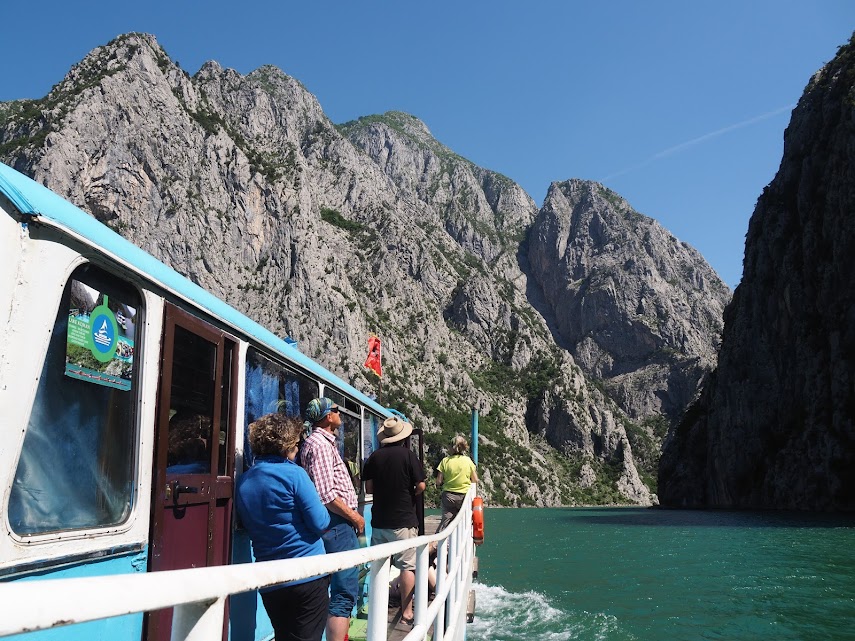
In proximity of the route one finds an abundance of interesting sights, the UNESCO world heritage listed Visiko Decani Monastery and Serbian Patriarchate in Peja/Pec, the Turkish old town of Gjakova and Prizren or the vibrant city Shkodra with its impressive castle that towers of the Balkans’ largest lake are only a few examples. Both the Shkodra and Koman Lakes entice with unique boat rides and the railway line between Belgrade and the Montenegrin port of Bar is among the most beautiful of the continent. Dubrovnik, the Pearl of the Adriatic, the Fjord-like Bay of Kotor, Ohrid in Macedonia or the uncrowded pristine beaches of the Albanian Riviera can be included in a journey.
Please mind the common dangers of mountain travel and alpine terrain, notably with regard to weather and temperature – many hikers underestimate those in Southern Europe. While it is never far to the next settlement, persistent heavy rains and fog can make it impossible to reach them. Keep in mind that you sometimes won’t have mobile phone coverage and that one can walk for few days without encountering other hikers. Only in Montenegro and Valbona Valley mountain rescue services exist, though only at a very basic level. Most of the time you will be on your own or rely on the local population.
Try to prepare and adjust to the Balkans’ mentality to avoid frustration, it can happen that a supposed 5-minute waiting time turns into half an hour and breakfast that should be ready at 7 am is served 20 minutes past. As a relic of socialist Yugoslavia the service orientedness isn’t fully developed in Montenegro, but the Kanun states: “The house of the Albanian belongs to God and the guest”. Generally all private hosts will do their best to make your stay an enjoyable one. Those living in the simplest condition will vacant their rooms and share their last loaf of bread with guests.
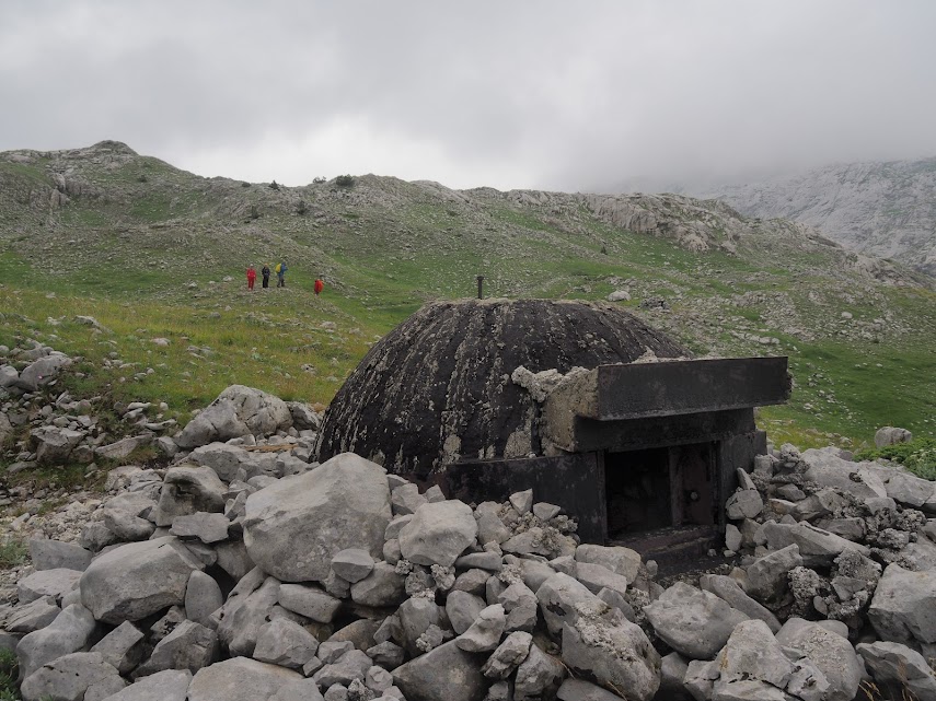
In 2007 land mine clearing was officially completed and the track is free of them. Marked mine fields exist far away from the main route in other parts of Kosovo. The Halo Trust based in Gjakova can supply more information and answer detailed questions http://www.halotrust.org/where-we-work/kosovo
People in the mountains, especially in Albania, live from pastoral farming and in transhumance. They move between winter villages and summer pastures and their flocks constitute their livelihood. The herds need to be protected from the very real danger of wolves and other wild animals, for this reason the Sharr shepherd dog is bred here. The Bavarian Broadcast called them calf-sized giants, make sure that the owner is nearby to assure certain passage them when you approach a flock. Mostly the dog will approach quickly and furiously bark but then keep distance, stay calm and if necessary use your sticks and stones to chase them off, even the gesture of throwing things can help. Normally the dogs aren’t danger but you should prepare yourself for such cases.
Wild animals are very timid as they are being hunted, you would be very lucky to see a wolf or bear, though they still exist in bigger numbers. Most of the locals have seen neither despite them spending their half life in the mountains. Above all, snakes should be treated with respect, generally none of the aquatic species are poisonous, nor do they inhabit high grass. Pay attention when walking across karstic sun-exposed rock fields or at the transition areas of forest. Both the nosed as well as horned viper, the most venomous snake of Europe, can be easily found here. After a bite you have 24h to receive the antidote before entering the life threating phase.
Most residents are, maybe especially here, honest people who will quote the regular prices and try to help to the best of their knowledge and belief. Unfortunately there are always some black sheep, those are mostly taxi drivers which charge non-locals high prices or recruiters waiting at bus stations for unwary travellers to offer transfers and accommodation. We suggest to turn down all offers in a friendly way, to try to get an overview yourself and compare different offers. A safe option is to ask accommodation to arrange drivers for a fixed price or to ask locals for the regular fare.
If you walk the whole Peaks of the Balkans route, especially outside mid-June to mid-September, be prepared to independently spend a night outside in the mountains (food and shelter).
Any other Questions? We can help!
We assist you with pleasure, if you have any questions that haven’t been answered above. However, please consider that during the summer time tour requests are given priority over information requests and a reply might take a few days. Contact us in English via [email protected] or via the contact form.
Should there be any mistakes or crucial things missing in this short guide to the Peaks of the Balkans, please notify us so we can correct or add those.
WANT more holidays with less hassle?
- If you want to make the most of your Peaks of the Balkans Trek while saving yourself countless hours of research, unnecessary stress and frustration, why not make use of our years of experience in creating unforgettable adventures for our clients? Why not let us take care of the red tape, booking and organising, while you focus on relaxing and enjoying your holidays? Join one of our guided tours, or hike independently at your own pace using our self-guided offers to:
- Choose the route and duration that best fits your personal preferences
- Let the experts pick the most beautiful trails to include in your trek
- Avoid boring forestry roads and instead enjoy the most scenic hiking routes
- Skip straight to the region’s highlights by shortening the least exciting parts with short transfers
- Attempt one or many peaks along the route
- Include a detour into the amazing Grbaja Valley or undiscovered Kelmend Region